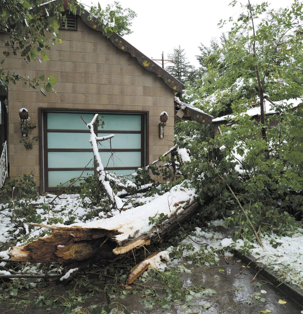
RBC | A strong low-pressure system dropped out of Canada this week, arriving on the doorsteps of Rio Blanco County residents early Tuesday in the form of freezing cold and heavy snowfall.
The wet snow and sleet combined with fully-leafed late summer trees meant snow piled up quickly, snapping branches, and by extension leading to multiple power outages. The snowfall also downed a power line in Meeker. White River Electric Association crews worked throughout the day Tuesday to resolve the outages as snow continued to fall. WREA reminded residents to never attempt removal of fallen trees or branches on or near power lines.
While summer snow is not unheard of for Rio Blanco County, the rapid change in both temperature and moisture caused whiplash for some residents, as temperatures transitioned from warm, dry and smoky to the opposite extreme.
“We have been unseasonably warm all through the month of August, and then we get hit with this unseasonably strong, cold low-pressure system dropping out of southern Canada,” said Dan Cuevas, hydro-meteorological technician for the National Weather Service, based in Grand Junction.
“It does happen, it’s not a real common thing. It is [now] unseasonably cold for this time of year. It’s not impossible, but it’s not something that we see real often either,” Cuevas said.
Meeker and Rangely residents should expect continued cold, rain and snow through Friday when things will start to “wind down.”
“Looks like there will be rain and snow showers into Thursday night, even Friday still isolated to scattered showers, possible thunderstorms. Looks like you might have to wait until Friday night and Saturday to be dry, to not have a chance of precipitation,” said Cuevas.
By Friday afternoon, temperatures should warm up, with highs in the mid 60s to low 70s. Cuevas said those forecasted temperatures look much closer to the seasonal norm for the area.
By LUCAS TURNER | [email protected]om