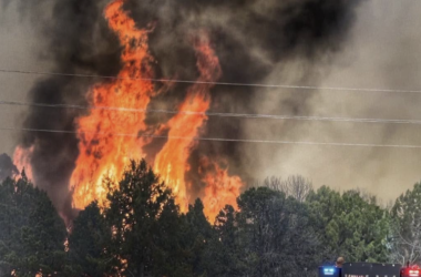
RBC | Precipitation exceeded the average across much of the state in February, but water users should still be planning for drought conditions this summer, according to the latest projections from the US Department of Agriculture Natural Resources Conservation Service (NRCS).
Colorado Snow Survey Supervisor Brian Domonkos said February storms helped to bring snowpack “more within the realm of normal” particularly in northern Colorado. (See GRAPH A.) The combined Yampa-White-North Platte river basins saw precipitation at 153% of average. Other basins with above average precipitation in February were the South Platte basin (140%) and Colorado (119%).
The Gunnison and Arkansas river basins saw near normal precipitation last month, while the Upper Rio Grande, San Miguel, Dolores, Animas and San Juan basins were below average, ranging from 60-70% of normal. The statewide average for precipitation in February was 105%, bringing statewide snowpack to 85% of normal.
Though total snowpack levels have improved, hydrologists are still projecting below-average streamflows throughout the state, mainly due to dry soil moisture conditions and low base river flows. “These will have significant impacts on spring and summer runoff,” said Domonkos.
NRCS Hydrologist Karl Wetlaufer explained that soil moisture levels in particular are due to the “exceptionally warm and dry” summer and fall of 2020. “The expectation is that snowmelt runoff will produce lower volumes than would commonly be observed with a similar snowpack,” said Wetlaufer.
According to Brian Domonkos, the state would need continued precipitation at above average levels to make up for the soil-moisture and base streamflow deficits, in order for projected stream flows to be anywhere near normal.
In the Yampa/White River basin, snowpack is currently around the state average at 85%, an improvement from this time last year when it was at 74%. Due to the increase in precipitation last month, the Colorado and Yampa-White river basins are also the only basins in the state with above average reservoir storage, at 103% and 113% percent respectively.
SNOWPACK v. PRECIPITATION
Domonkos said it is important to note that snowpack is “highly dynamic” and distinct from precipitation. Referring to the snowpack measurement levels he said “portions of it can come and go with drifting, scouring, melting and freezing and other weather processes,” adding “total precipitation captured does not reflect the changes that snowpack often experiences.”
STREAMFLOWS
Based on the latest data, water supply forecasts for the state are well below average. The latest projected flows for the White River near Meeker are just 58% of NRCS’ 30-year average. Projections for other sites in the region are 71% for the Yampa River near Maybell, 48% for Elkhead Creek above Long Gulch, 58% for the Roaring Fork at Glenwood Springs, and 66% for the Colorado River near Cameo.
The lowest streamflow forecasts in the state are coming out of the Southern San Juan Mountains and the Gunnison River Basin. The average of forecasts in these basins is for 54 and 57 % of average volumes, respectively. The highest streamflow forecasts in the state are in the South Platte, with the average of forecasts being for 80 % of average streamflow volumes. (See MAP B.)
More details on water supply projections can be found in the March 1 Water Supply Outlook Report which will is available online at https://www.wcc.nrcs.usda.gov/ftpref/states/co/wsor/borco321.pdf
By LUCAS TURNER | [email protected]om