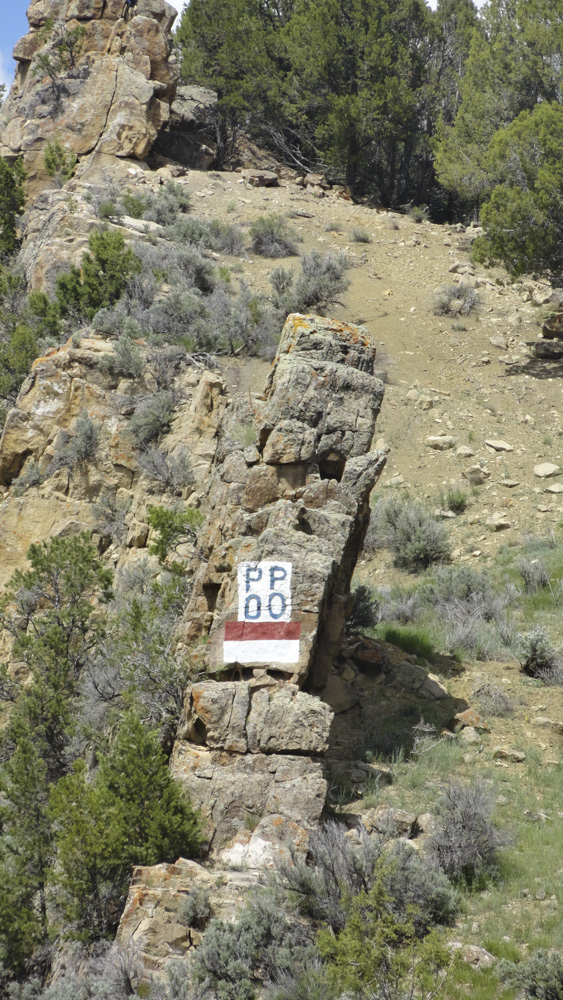
RBC | There was a TV show in the 1960s called Route 66. Young and handsome Martin Milner starred in this endless road trip in a cool 1961 corvette convertible. He and his buddies cruised Route 66 which zig-zagged from Chicago to LA and never touched Colorado.
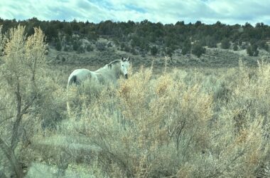
We didn’t have Route 66 but Rio Blanco County did have an earlier version of a trans-continental highway. We had a road promoted as the “American Appian Way.” The original Appian Way was an ancient Roman road famous for its length. And as they used to say, what has that got to do with the price of eggs?
As newcomers to Meeker, Tracy and Ed traveled from Rifle to Meeker passing an outcropping on the east side of Highway 13 painted with four letters, PP above OO. It is near mile marker 36, in area we are normally dodging wildlife, potholes or CDOT repair trucks. A lot of local people know that the “PP OO” was the highway marker for the Pikes Peak Ocean to Ocean highway.
I need to turn the clock back to 1914, to a time when automobiles were toys for rich people. The one lane roads were mostly unpaved and still followed wagon trails, stage routes and rivers. Mass manufacturing of gasoline-powered vehicles was new and beginning to lower production costs to the point that American middle class people might aspire to own one. Henry Ford said you can have any color you want, as long it was black. A trip back then of 20 miles meant at least one flat tire to change.
The Federal government didn’t get involved with the concept of national roadways and numbered highways until about 1926. Before then, roads or trails just had names, not numbers. The road which stretched from Rifle to Meeker was simply known as the “Government Road.” It was built by the U.S. Calvary to supply the military camp on the White River. It was some 40 years before trucks replaced horse-drawn stagecoaches and freight wagons on the Government Road.
Automobile manufacturers began actively promoting the gas-powered passenger vehicle as a way to see America without being confined to parts served by railroads. We already had transcontinental railways, but you could only stop only where there was a depot. Cars were promoted as the new freedom for adventurous Americans.
Before 1920, there were several groups interested in creating Atlantic to Pacific routes to allow cars to travel the 3,500 miles without worrying about getting lost or being too far from fuel stops. A group of merchants and businessmen in 1914 Colorado Springs wanted a route to come through Colorado and bring more tourists to the Pikes Peak area. The Meeker Herald’s July 25, 1914, edition reported a group scouting the proposed route. The committee visited Meeker in a 1914 five-passenger Buick with Kelley-Springfield tires. You can see the inspiration behind the proposed highway name of “Pikes Peak Ocean to Ocean Highway. The American Appian Way.” The entire route name would have been hard to put on road markers. Instead of a small square sign, you would need a small billboard. For practicality, the road markers were abbreviated to PP OO. Most of the signs were painted red and white with black letters. It wasn’t until much later that the federal government assigned route numbers and started funding road building.
The Colorado Springs contingent took their campaign to a St. Louis, Missouri, meeting of state and Federal officials. They promoted the route as a “fast” way to take a passenger car along a route following already established roads. The burden of marking and improving the roads was to be borne by local, county and state organizations who would benefit from the increase in tourist dollars.
The original planned route was to start in Washington D.C., and follow existing roads to San Francisco. The route, as completed in 1924, started in New York City and roughly following the 40th parallel to Los Angeles, skirted most of major cities along the way. Our historic portion went through Rifle, Meeker and Rangely, Colorado, and on through Vernal, Roosevelt and Salt Lake City, Utah. For a complete map, visit fhwa.dot.gov.
In 1927 a caravan of cars started out in NYC on July 18 and arrived in LA on Aug. 11. They drove 106 hours, 3,286 miles, averaging 31 miles per hour. All but 670 miles were paved roads. The number of flat tires enroute was not reported.
Sources: The Meeker Herald, Kay Bivens, RBC Historical Society, the Federal Highway Administration, general highway history tab and www.ppoo.org. If you know of other PPOO road signs in RBC, please let us know
BY ED PECK AND KAY BIVENS
Special to the Herald Times
This is a very interesting read! I have always wondered what that was. Thank you for the article!! Now the question is……who keeps the paint up??